
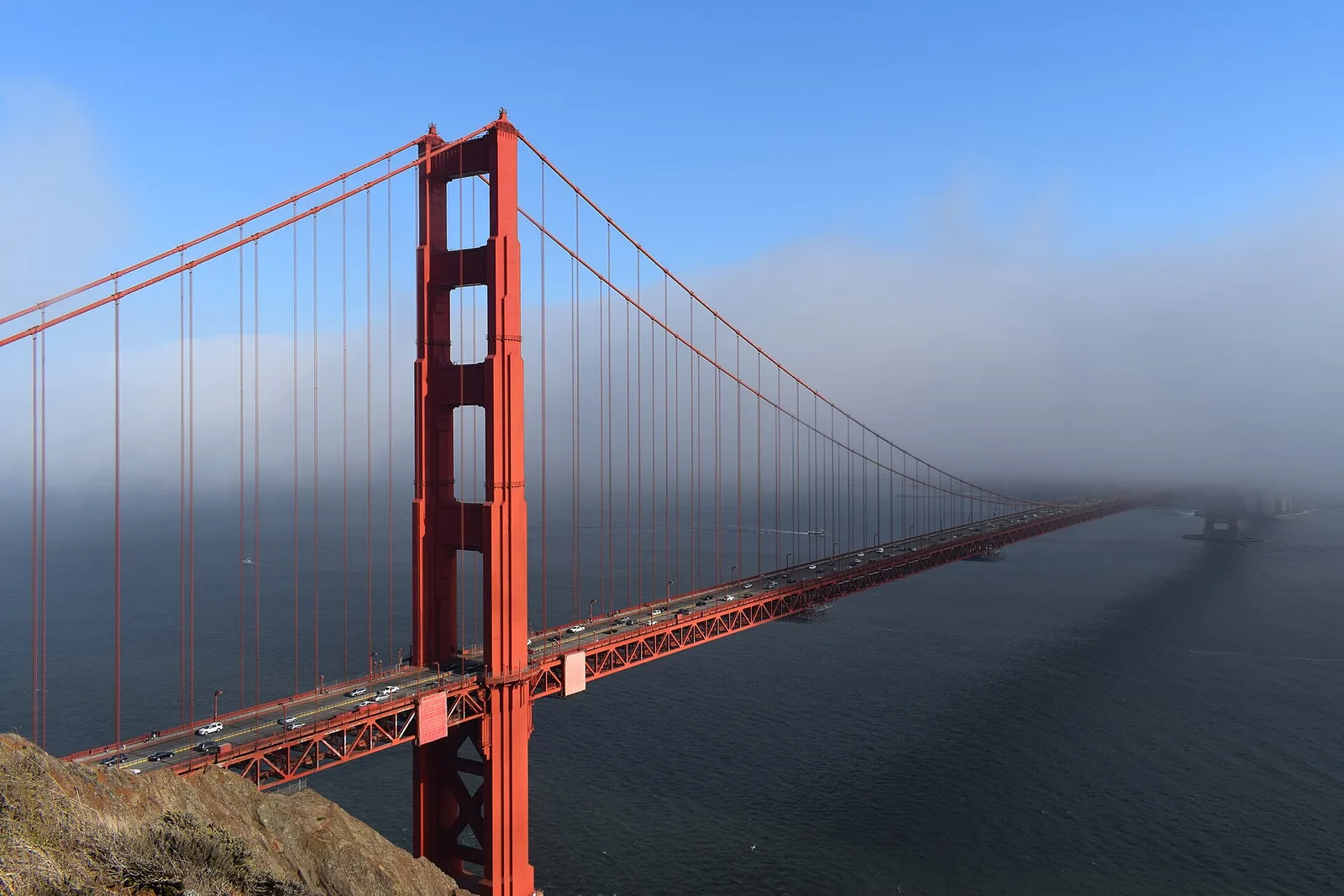
The Marin Headlands are the hills just across the Golden Gate Bridge from San Francisco, and they have the classic postcard views of the bridge with the city behind it. You can drive up Conzelman Road to Battery Spencer and Hawk Hill in about 15 minutes from the bridge, then keep going to Rodeo Beach, old military batteries and, on one Saturday a month, the trail to Point Bonita Lighthouse. Here’s how to plan it, with hours as of November 2026.
In this guide
This guide is part of our outdoor activities in San Francisco hub.
At a glance
| Details (as of November 2026) | |
|---|---|
| Where | North end of the Golden Gate Bridge, in the Golden Gate National Recreation Area |
| Cost | Free to enter, no park fee |
| Best views | Battery Spencer, Hawk Hill and pullouts along Conzelman Road |
| Beach | Rodeo Beach at Fort Cronkhite |
| Point Bonita trail | Third Saturday of each month, 12:30 to 3:30 pm. Suspension bridge closed |
| Nike Missile Site SF-88 | First Saturday of each month, noon to 3 pm |
| Transit | Muni 76X on weekends and most holidays |
| Time needed | Two hours for the viewpoints, a full day with hikes |
Getting there
By car
From San Francisco, cross the Golden Gate Bridge heading north and take the Alexander Avenue exit, the first one after the bridge. Follow signs to the Marin Headlands and Conzelman Road. Heading north across the bridge is free. You pay the toll coming back into the city, and the bridge has no cash booths, so read our Golden Gate Bridge guide for how tolls work.
Parking at the viewpoints is limited and fills quickly on sunny weekends, especially at Battery Spencer. Go early in the morning or on a weekday. Don’t leave anything visible in your car. Break-ins at scenic parking areas around the Bay Area are a well-known problem.
Bunker Road, the other way into the valley, passes through the Barry-Baker Tunnel, a one-lane tunnel controlled by a traffic light. Expect a wait of a few minutes.
By bus
Muni’s 76X Marin Headlands Express runs on Saturdays, Sundays and most holidays, connecting downtown San Francisco with major sites in the headlands, according to the National Park Service’s map. Check the SFMTA site for the current schedule before you go. Our Muni guide explains fares.
By bike or on foot
Many people bike across the Golden Gate Bridge and climb into the headlands. Conzelman Road is steep. You can also hike up from the north end of the bridge on trails, which takes some effort but needs no parking.
Viewpoints along Conzelman Road
Battery Spencer
Battery Spencer, a short walk from a small parking area on Conzelman Road, is the closest viewpoint to the bridge. You look straight across the north tower with the city skyline behind it. It’s one of the most photographed spots around the bay, and the parking lot is small. Our best views in San Francisco guide includes more spots for bridge photos.
Hawk Hill
Farther up Conzelman, Hawk Hill sits above the bridge with wide views of the city, the Pacific and the headlands. The Golden Gate National Parks Conservancy lists it as open around the clock. It gets its name from the hawks and other birds of prey that pass over it, especially during fall migration, when volunteers count raptors here.
Past Hawk Hill, part of Conzelman Road becomes one way heading downhill toward the coast. Drive slowly, because the road is narrow and has steep drops.
Sunrise and sunset
Both viewpoints are popular at sunrise and sunset. Fog often rolls through the Golden Gate in summer and early fall, so you may get fog swirling around the towers or no bridge at all. Check our San Francisco fog guide for when it’s most likely.
Point Bonita Lighthouse
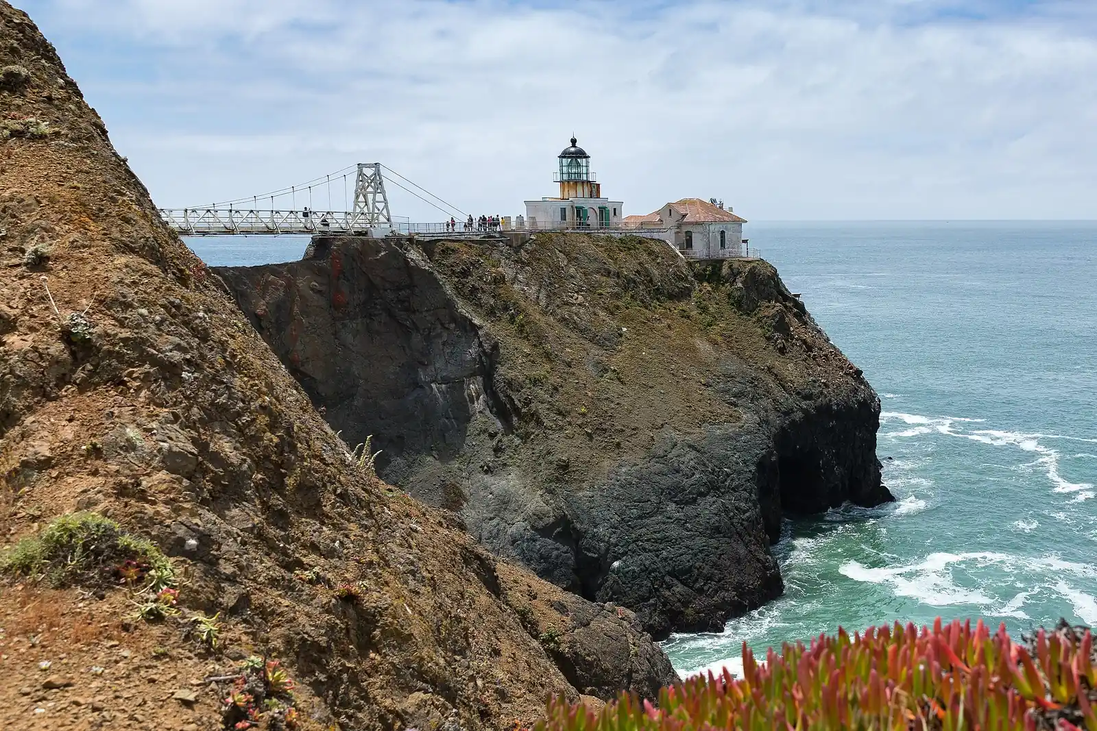
Point Bonita Lighthouse sits on a rocky point at the tip of the headlands. According to the National Park Service, the lighthouse has guided ships into San Francisco Bay since 1855.
Access is limited. As of November 2026, the NPS Point Bonita page says the Point Bonita Trail to the lighthouse viewing platform is open only on the third Saturday of each month, from 12:30 to 3:30 pm. The suspension bridge that leads to the lighthouse itself is closed until further notice, so you can see the lighthouse from the platform but not walk out to it. Pets, bikes and smoking aren’t allowed on the trail. Parking is limited, and the Battery Alexander lot is a short walk away.
Bring binoculars. The NPS notes that harbor seals, whales and porpoises are often seen from the area. The Park Service also recounts the 1901 wreck of the steamer SS City of Rio de Janeiro near Point Diablo, which sank in about ten minutes with 128 passengers lost.
Rodeo Beach and Fort Cronkhite
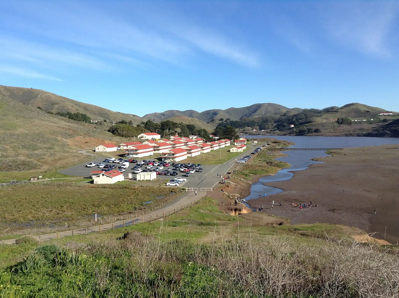
Rodeo Beach is a small beach between steep bluffs at the end of Bunker Road, with a lagoon behind it. The sand has lots of small colorful pebbles. The surf can be dangerous, with strong currents and sneaker waves, so it’s better for walking and watching surfers than for swimming.
Fort Cronkhite, the old Army post above the beach, has World War II era buildings and gun batteries. The Coastal Trail climbs from the beach to the bluffs, with views up and down the coast.
The Marine Mammal Center, a hospital that rescues and treats sick and injured seals, sea lions and other marine mammals, is near Rodeo Beach. Visitors can see the center and learn about its work. Admission has been free with advance reservations, but check the Marine Mammal Center website for current days and hours.
Military history
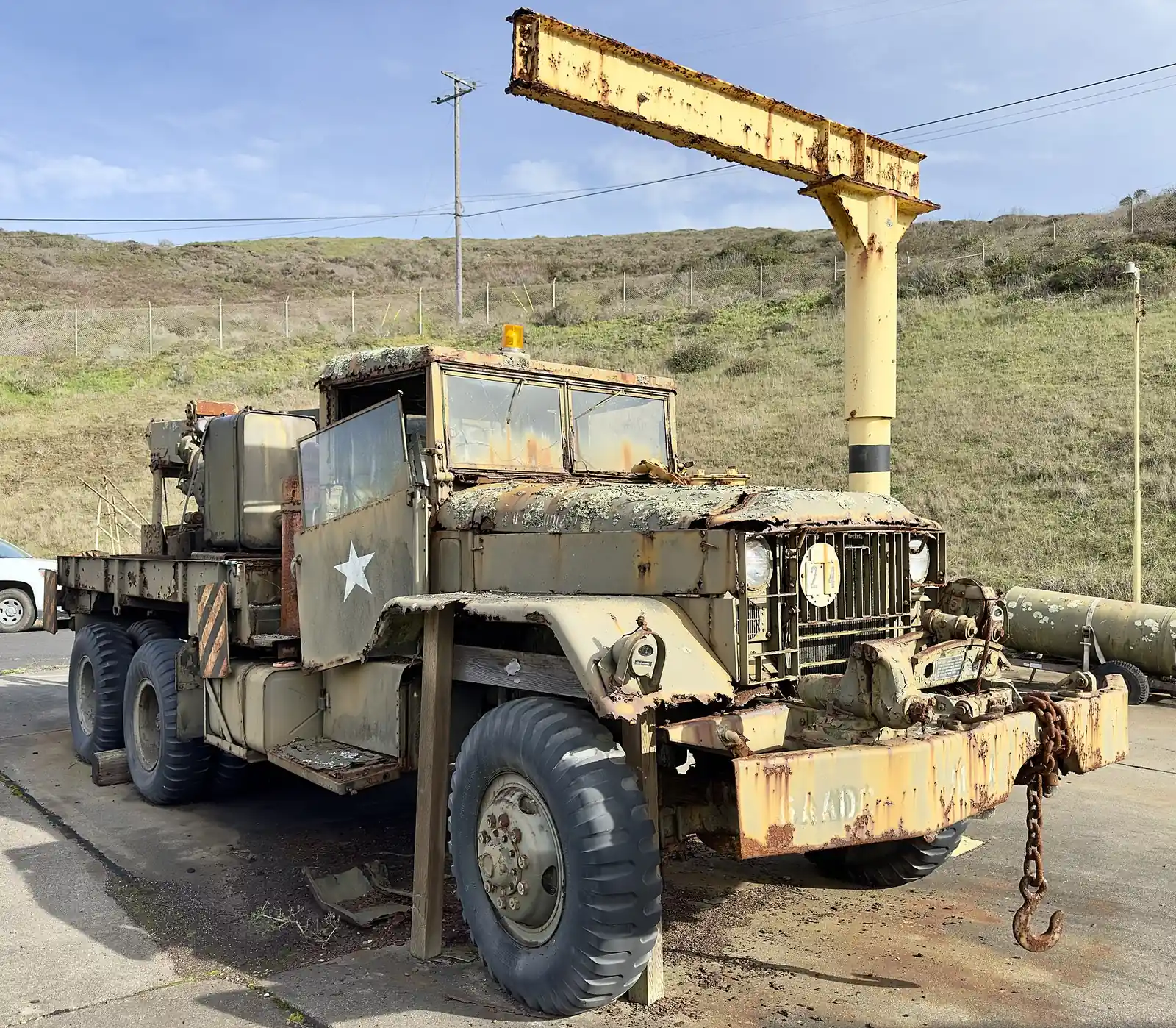
The headlands were part of San Francisco’s harbor defenses for about a century, and the concrete gun batteries, bunkers and tunnels are still there to explore.
Nike Missile Site SF-88
The NPS calls SF-88 the most fully restored Nike missile site in the country. During the Cold War, from 1953 to 1979, the U.S. Army built close to 300 Nike missile sites, designed as a last line of defense against Soviet bombers. As of November 2026, the NPS Nike Missile Site page says it’s open only on the first Saturday of each month, from noon to 3 pm, and closed in bad weather. Volunteers help preserve it. The only restrooms at the site are portable toilets, so the NPS suggests stopping at a larger restroom about a mile before on Field Road.
Batteries
You’ll find old gun batteries all over the headlands, including Battery Spencer and Battery Alexander. Most are open to walk around but have uneven ground, dark corners and drop-offs. Bring a flashlight and watch kids closely.
Hiking in the Marin Headlands
The headlands have miles of trails through coastal hills and valleys. Here are a few to start with.
Coastal Trail to Hill 88
From Rodeo Beach, the Coastal Trail climbs to the old radar site on Hill 88, with big ocean views. It’s a strenuous climb. Bring layers, because it’s windy at the top.
Rodeo Lagoon loop
An easy walk around the lagoon behind Rodeo Beach, good for birding.
Bridge to Battery Spencer
You can hike from the north end of the Golden Gate Bridge up to Battery Spencer and beyond, a short but steep walk.
Check the NPS Marin Headlands map for trail routes and distances. For a coastal walk on the city side of the Golden Gate, try our Lands End trail guide.
Visitor center and facilities
The Marin Headlands Visitor Center, in an old chapel near Fort Barry, has exhibits on the area’s history, maps and rangers who can answer questions. Hours have varied, so check the NPS hours page before you go. Restrooms are at the visitor center, Rodeo Beach and some parking areas. There’s very little food in the headlands, so bring water and snacks.
When to visit
The headlands are open year-round, and each season has its own look.
Fall
September and October often bring the clearest weather of the year around the Golden Gate, with less fog than summer. Fall is also hawk migration season over Hawk Hill. It’s a great time for photos.
Winter
Winter brings rain storms between clear, crisp days. The hills start turning green after the first rains, and the views on a clear day after a storm can be spectacular. Trails can get muddy.
Spring
The hills are at their greenest, and wildflowers bloom along the trails. Wind picks up in the afternoons.
Summer
Summer is the foggiest season. Fog often pours through the Golden Gate in the afternoons, sometimes leaving the bridge towers poking out above it. Mornings are sometimes clearer. Bring a warm jacket even in July and August. Our weather by month guide explains the pattern.
Tips for visiting
- Dress in layers. The headlands are often windier, foggier and colder than the city.
- Go early on weekends. Parking fills by midmorning on clear days.
- Plan around first and third Saturdays. That’s when you can visit the Nike site and the Point Bonita trail.
- Watch for bikes. Conzelman Road is popular with cyclists.
- Don’t leave valuables in the car. Take them with you.
- Stay off cliff edges. The bluffs are crumbly and the drops are steep.
Combining the headlands with Sausalito or Muir Woods
The headlands pair naturally with a stop in Sausalito, just north. See our Sausalito day trip guide. You can also continue to Muir Woods, though you’ll need a parking or shuttle reservation there. Our Muir Woods guide explains how to book.
A simple day might look like this:
- Morning: Battery Spencer and Hawk Hill before the crowds.
- Late morning: Drive to Rodeo Beach and walk to the bluffs.
- Lunch: Sausalito.
- Afternoon: Ferry back to San Francisco, if you biked, or drive back across the bridge.
For more ideas across the region, our sister site Trip Musing covers California road trips.
Frequently asked questions
Is the Marin Headlands free?
Yes. There’s no fee to enter the Marin Headlands or to park at the viewpoints, as of November 2026. You’ll pay the Golden Gate Bridge toll when you drive back into San Francisco.
Where is the best view of the Golden Gate Bridge in the Marin Headlands?
Battery Spencer has the closest view of the bridge with the city behind it. Hawk Hill, farther up Conzelman Road, has a higher, wider view.
Is Point Bonita Lighthouse open?
As of November 2026, the Point Bonita Trail to the viewing platform is open only on the third Saturday of each month from 12:30 to 3:30 pm, according to the National Park Service. The suspension bridge to the lighthouse is closed until further notice.
Can you get to the Marin Headlands without a car?
Yes. Muni’s 76X runs on weekends and most holidays. You can also bike or walk across the Golden Gate Bridge and climb into the headlands.
Can you swim at Rodeo Beach?
Swimming isn’t a good idea. The water is cold and the surf and currents can be dangerous. It’s better for walking, picnics and watching the waves.
Photo credits
Featured image: Radomianin / Wikimedia Commons, CC BY-SA 4.0; Point Bonita Lighthouse and its footbridge: Frank Schulenburg / Wikimedia Commons, CC BY-SA 4.0; Rodeo Beach and Fort Cronkhite: Kiddo27 / Wikimedia Commons, CC BY-SA 4.0; Nike Missile Site SF-88: Gregory Varnum / Wikimedia Commons, CC BY 4.0.